Southwest Vacation Feb23 - Death Valley NP
Star Wars Canyon
|
|
Leaving Stovepipe Wells, we headed west on Highway 190 up and over the Panamint Range, through Towne Pass at 4,956 feet, then down into Panamint Valley, through the town of Panamint Springs, and back up Darwin Plateau. All this time we were still in Death Valley National Park. On Darwin Plateau we checked out the Father Crowley Vista Point. Imagine my surprise when I discovered it is right next to Rainbow Canyon, better known as Star Wars Canyon due to the military fighter jets who fly down through it. I had heard of Star Wars Canyon but didn't know where it was. And now I was here. A pleasant surprise!
|
| |
 |
|
|
Looking at the east side Star Wars Canyon which empties out into the Panamint Valley.
|
| |
 |
|
|
Looking northwest where Star Wars Canyon comes from. The Canyon really isn't that long. It probably only takes a military jet a few seconds to fly it.
Unfortunately, no military jets, or any other planes flew the canyon while we were here. But I found the following video: Link.
This area lies within the Panamint Military operations area, part of the R-2508 Complex so I'm guessing general aviation airplanes can't fly here.
|
| |
 |
|
|
From this shot, it's easy to see why they call it Rainbow Canyon.
|
| |
 |
|
| Looking out into the Panamint Valley. There are sand dunes at center in the valley. |
| |
 |
|
| Panamint Valley is part of the Death Valley National Park. |
| |
 |
|
A plaque honoring Father John J. Crowley, also known as the Desert Padre, for whom this vista point is named. He was an early 20th century Catholic priest in California's large but sparsely populated Eastern Sierra. He served there from 1919 to 1940, with an interlude, mainly in Fresno, from about 1924 to 1934. He is remembered for his prodigious efforts to help improve the economic well-being of all Eastern Sierra residents. His efforts in the Eastern Sierra centered largely on enhancing tourism to the remarkable area, which includes the lowest geographical point, in Death Valley, and the highest point (at that time, among the 48 states), Mount Whitney. Nature lovers, campers, hikers, and sport fisher persons were addressed; stars in the many movies filmed in the area were engaged |
| |
 |
|
|
We drove the car on a dirt road out to a lookout point.
|
| |
 |
|
| |
| |
 |
|
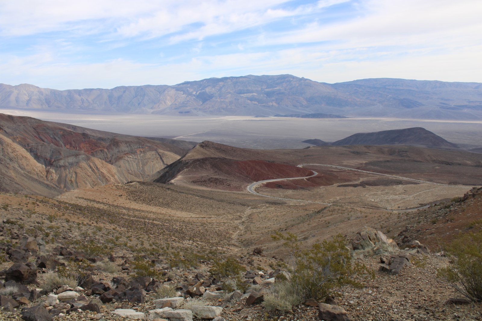
| That's the road we drove up on. |
| |
 |
|
| You can just see the little town of Panamint Springs down there on this side of the valley. |
| |
 |
|
|
Where Star Wars Canyon empties out into the valley.
|
| |
 |
|
| Driving away from Father Crowley Vista Point, one last look at Star Wars Canyon. |
| |
 |
|
|
The canyon then petered out.
|
| |
 |
|
| Shortly thereafter, we exited Death Valley National Park. We were still on Highway 190 though and soon the eastern Sierra Mountains came into view. Even though I grew up in California, it was northern California and I spent almost no time in southern California. So seeing the eastern Sierras was a first for me. |
| |
 |
|
| We turned south onto Interestate 395 parallel to the Sierras. |
| |
 |
|
| Eventually we left the Sierra Mountains and headed southeast, then east to Barstow. From there it was southeast to Joshua Tree. It was through the Mojave Desert like this all the way. |
| |
 |
|
| |
| |
|
|
|
|
|
|